WALKS AROUND SPEAN BRIDGE – SPEAN BRIDGE STATION SIGNAL BOX, FORT AUGUSTUS AND INVERGARRY RAILWAY VIADUCT AND TRACKBED, GENERAL WADE BRIDGE AND COMMANDO MONUMENT
Spean Bridge is a small village that lies nearly 10 miles north east of Fort William and is the last station on the West Highland Railway, before “The Fort’ (An Gearasdan in Scots Gaelic). The station opened in 1894 and in 1903 became a junction for the newly opened Fort Augustus and Invergarry Railway (FA&IR) one of the last ‘railway mania’ projects that cost its investors dearly and delivered little in terms of profit. Not surprisingly, the line closed to passengers in 1933, and to freight in 1947. Parts of the trackbed and some of the structures remain. Spean Bridge station has the last remaining wartime style signal box on the line, of which several were built during WW2, due to heavier train traffic, and the strategic importance of the line. An information board at the station provides details of the station’s wartime role.
From Mallaig and Fort William, arrive at 0756hrs or 1153hrs. From Glasgow and the South, arrive at 0938hrs (sleeper service, seat booking may be required) or 1154hrs, see:
http://Scotrail.co.uk
http://Realtimetrains.co.uk
Spean Bridge has one of the best preserved stations on the West Highland Line. It has two platforms, as opposed to a single ” island” platform (like most of the other stations on the route), with the main station building on the up (southbound) side.
The station building now houses “The Old Station Restaurant”
(see Facebook, Trip Advisor and Instagram)
At the east end of the up platform is the last surviving wartime style signalbox on the line. Although completed in 1949, it is of typical LNER art deco design of the 1930s.

Spean Bridge signal box
The Lochaber area was used extensively as a training ground for Allied special forces from many countries during WW2, due its rugged terrain, isolation and distance from the ‘home front’, and the existence of several large estates to billet the troops. On formation in 1940, the original soldiers of the British Commando Unit trained here, as did the Special Operations Executive and Special Air Service later in the war. Just outside Spean Bridge lies the Commando monument.
To walk to the monument, leave the station, and walk towards the main A82 road, crossing the River Spean. Turn left, north west, after the bridge and follow the A82 sign for Inverness. The monument is sign posted on the A82 and after a short distance, a footpath leaves the road. There is an information board and sign post “Commando Memorial via High Bridge” at the start of this pleasant woodland path that thereafter follows the river.

Signpost at start of footpath
After about 1 km the abutments of the old railway viaduct over the Spean which carried the FA&IR emerge from the woodland.
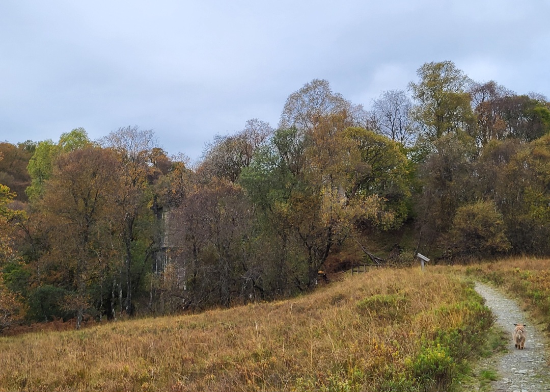
Remains of FA&I railway viaduct
An information board gives a short history of the railway and the path merges with the old trackbed just beyond the remains of the viaduct.

Footpath/trackbed junction
Follow the path/trackbed and in another 500m the remains of the “High Bridge” built in 1736 by General Wade are reached. The first skirmishes of Bonnie Prince Charlie’s campaign of 1745 took place here; an information board gives more details.

Remains of 18th century “High Bridge”
A short distance further on the path turns north east and leaves the trackbed, which continues north west and becomes more difficult to navigate. Another old railway bridge lies just south of the path towards the Spean at this point, and can be visited.

Old FA&I railway bridge and trackbed
Leave the trackbed and follow the path uphill for approximately 250m towards a more open area and in a short distance, a cluster of buildings near the B8074 road are reached. The Commando monument, memorial garden, information board and car park lie a sort distance east along this road.
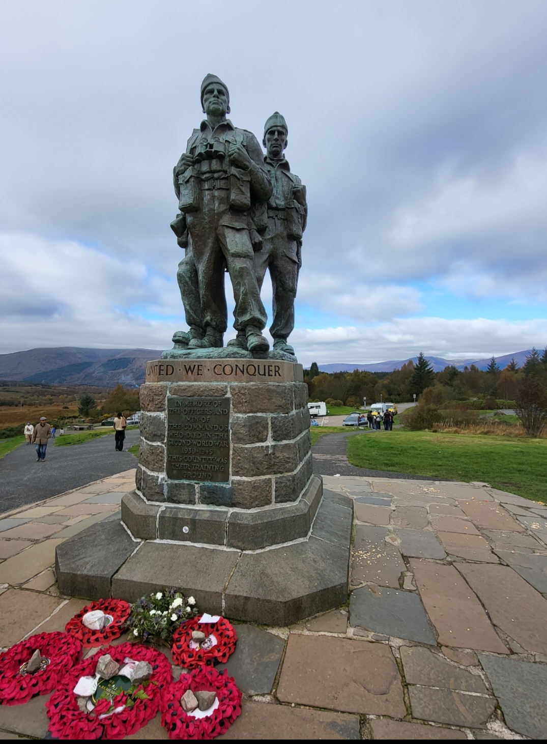
Commando Monument from the East
Go back to Spean Bridge following the same route in reverse, or alternatively, the B8074 joins the A82 back to Spean Bridge a short distance east of the monument and offers a quicker, if less tranquil return.
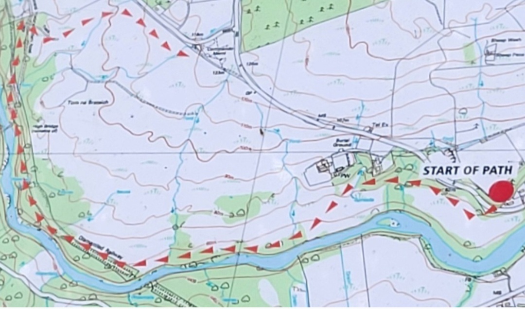
Map of Pathway/old trackbed
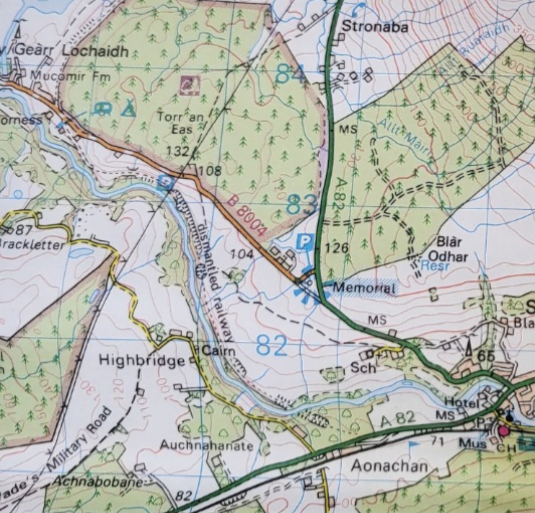
Map of area (OS Landranger 41)
Depart for Fort William and stations to Mallaig at 1556hrs or 2152hrs, and to the South and Glasgow at 1750 or 2007hrs (sleeper service, seat booking may be required) see:
http://Scotrail.co.uk
http://Realtimetrains.co.uk
Summary
Distance: 7km
Duration: 2 to 3 hours
Height: minimal, undulating path, short climb from pathway to monument
Terrain: Easy woodland walk and ex railway trackbed, mostly flat
Map: OS Landranger 41 and map of route on info boards
If, at the end of this walk, perhaps between trains, you fancy further walking, there are forest trails on the south side of the station. Cross the railway by the road bridge and signposts are located at the entrance to the woods in front of the golf club house. Alternatively, you can follow the River Spean eastwards towards Roy Bridge, which lies on the other (north) side of the river. A tarmac road along the south bank of the Spean starts just outside Spean Bridge station. Instead of heading towards the A82 road, turn immediately right from the station and follow the road passing a small church and some houses, and continue east along the river bank amidst lovely wooded and pastoral countryside.
PLEASE NOTE, IF WALKING THIS ROUTE, THE RIVER CANNOT BE CROSSED UNTIL THE MONESSIE BRIDGE IS REACHED APPROXIMATELY 8 KM TO THE EAST
Words and photos by John Gilchrist
We want to keep our roads less busy and our air less polluted. See our Projects.