“TRAINSPOTTING” HILL – LEUM UILLEIM CIRCUIT
Anyone who has seen the 1996 cult film “Trainspotting” will remember the scene where the four main characters visit a remote Highland station with a hill in the background, and where Ewan McGregor’s character, ‘Renton’, pontificates about
“Being Scottish”.
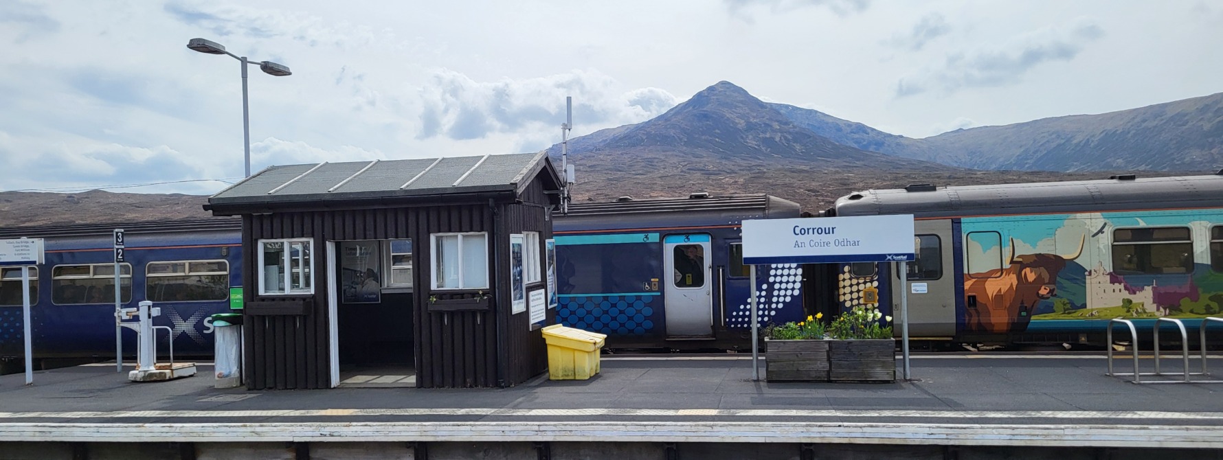
The station is Corrour, the highest railway station in Scotland (and UK), the hill is Leum Uilleim (909 m/2982 feet) which, from Gaelic translates as “William’s leap”. Being just under 3000 feet, the hill is not quite a ‘Munro’ but is a ‘Corbett’. A visit offers a short and rewarding walk with great views of Rannoch Moor and the Nevis range mountains of Lochaber.
Arrive at Corrour station, which is located at 407m (1338 feet) above sea level, at 0832hrs or 1230hrs from the North or from the South at 0858hrs (sleeper service with seating), 1121hrs or 1524 hrs (at this time in summer only due to walk length/light conditions), see

Corrour station platform with Leum Uilleim behind
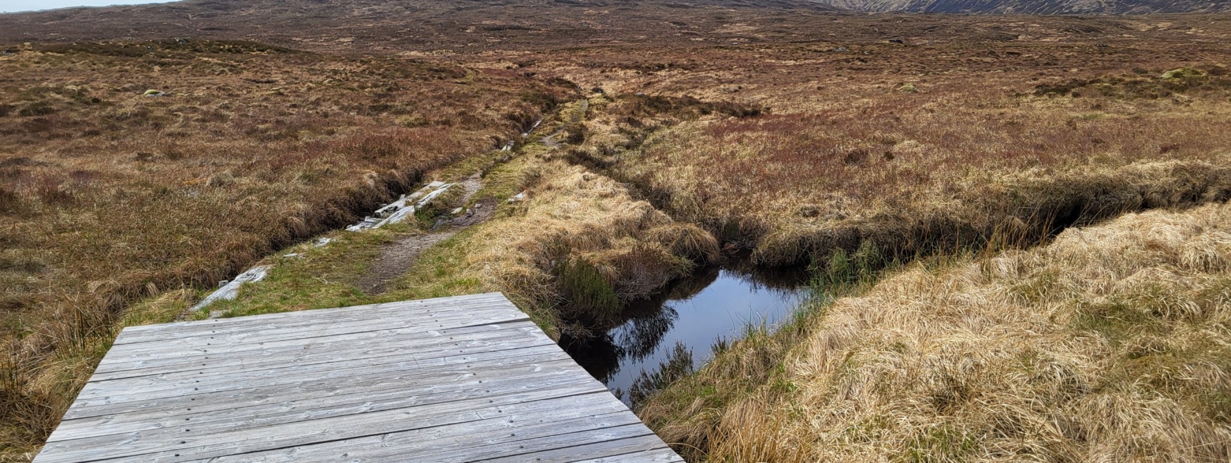
From the North end of the station platform, turn left (west) cross the railway and you will immediately see a 2 path junction with a signpost pointing north to Kinlochleven and Loch Treig and a path heading in that direction. Another vehicle track heads west towards Leum Uilleum. Take the westerly track, which is initially well defined but soon fades out.

Initial track towards Leum Uilleim
A stalkers path can be seen leading up the shoulder of Leum Uilleim, Sron an Lagain Ghaibh ridge, further to the South west, and requires a short period of “bog hopping” to reach it. Turn southwest and cross a patch of peaty bogland until you come across the path which heads towards the ridge, leading to the summit of Leum Uilleim. This path is quite steep and gradually climbs over the next 2km, although faded in places, it is generally well defined.

Stalkers path towards Leum Uilleim
Continue to climb the ridge path, which is quite rocky in places, until a plateau is reached and from which, the large cairn of the summit of Leum Uilleim can be seen, approximately 1 km to the west

Plateau looking towards Leum Uilleim summit cairn
The walk towards the summit cairn is undulating but easy, the terrain largely grassy with rocks in place. The cairn itself is large and to its north east side, it has a small stone shelter built into it as protection against the wind. Views from the summit are spectacular, Loch Ossian to the East, Loch Treig to the North, the Nevis range of mountains to the North West and the flat expanse of Rannoch Moor and the Glencoe mountains to the South.

View from Leum Uilleim summit cairn towards Ben Nevis
Return to Corrour by retracing your steps or alternatively, traverse the circuit walk back to Corrour over the Tom an Eoin ridge that lies on the opposite side of the Allt Coire a Bhric Beag river from Leum Uilleim.
To return to Corrour via the circuit, descend the gentle slopes to the north of the summit to the coll between Leum Uilleim and Beinn a Bhric (876m), which lies to the west. From the Coll a Bhric Beag, cross the small Allt Coire a Bhric Beag river, which originates here (initially flowing north east, then north west into Loch Treig).
Ascending on the north side of the Coll, the Tom an Eoin ridge, which has a well defined vehicle track, initially ascends, and thereafter descends over the next 4 km in a north easterly direction towards An Diollaid, from the bottom of which, a vehicle track back to Corrour can be taken.

Coll a Bhric Beag and track to Tom an Eoin ridge
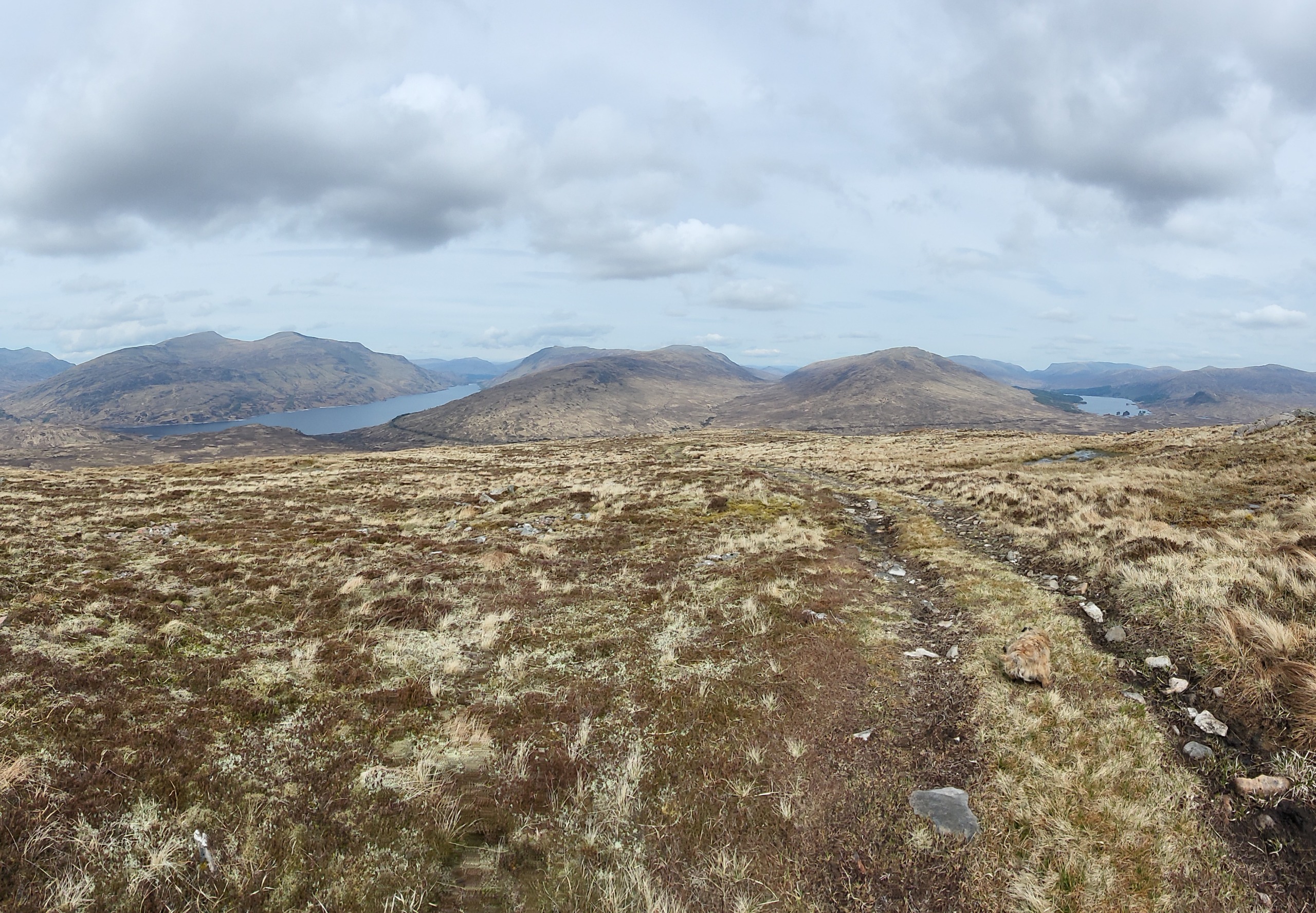
Loch Treig (left) and Loch Ossian (right) from Tom an Eoin ridge
As you descend in a north easterly direction Corrour station comes into view to the south, as does the railway and a rough vehicle track that links Loch Treig with Corrour. The ridge track fades out and becomes boggy in places but eventually a junction with the Loch Treig to Corrour vehicle track is reached. Turn right and take the short walk south to Corrour station, passing the ‘CORROUR SUMMIT 1350ft (411m) ABOVE SEA LEVEL’ railway sign en route.
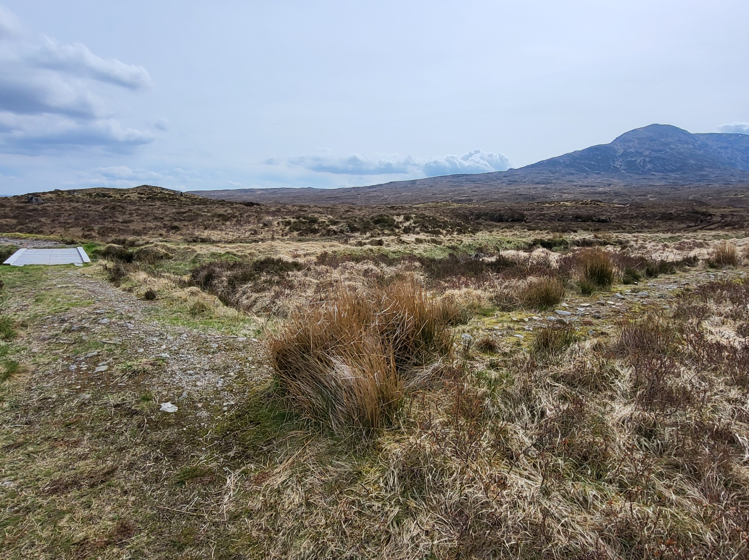
Track junction, track from An Diollaid and Tom an Eoin on right, track to Corrour on left
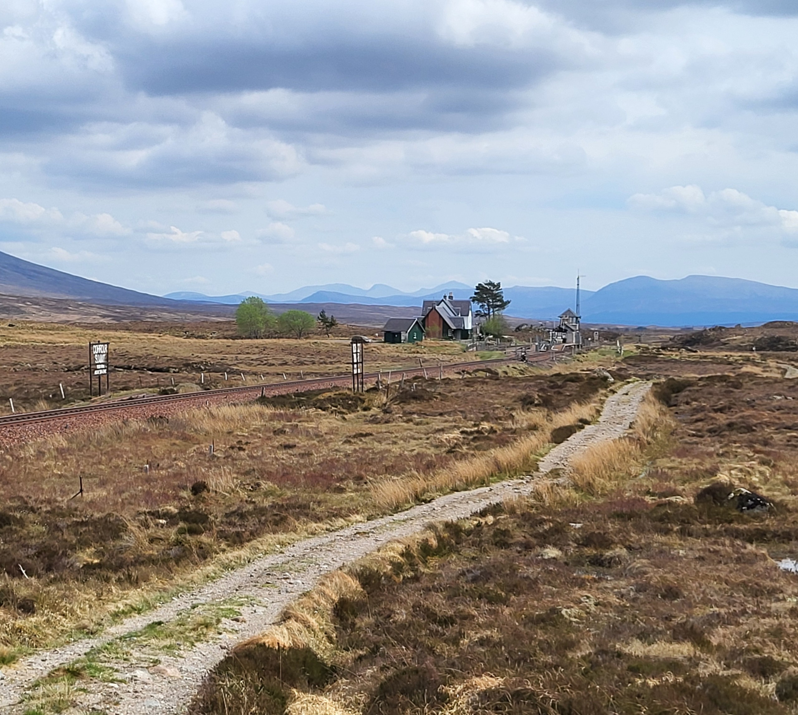
Corrour railway summit sign and station
The walk can be completed in the opposite direction, by first traversing An Diollaid and Tom an Eoin ridge, descending to the Coll and then ascending Leum Uilleim, before returning to Corrour by Sron an Lagain Ghairbh ridge.
Corrour station house opposite the island platform offers food, drink and accommodation, see
https://www.corrour.co.uk/station-house/
Return North from Corrour Station at 1524hrs or 2021hrs, return South at 1825hrs or 2051hrs (sleeper service with seating).
Summary
Distance: 7 km
Duration: 3-4 hours
Height: Approx 500m (1600 feet) of climbing to Leum Uilleim, additional short ascent onto Tom an Eoin ridge
Terrain: Mountain track, boggy and rocky in places, grassy and rocky on summit plateau
Map: OS Landranger 41
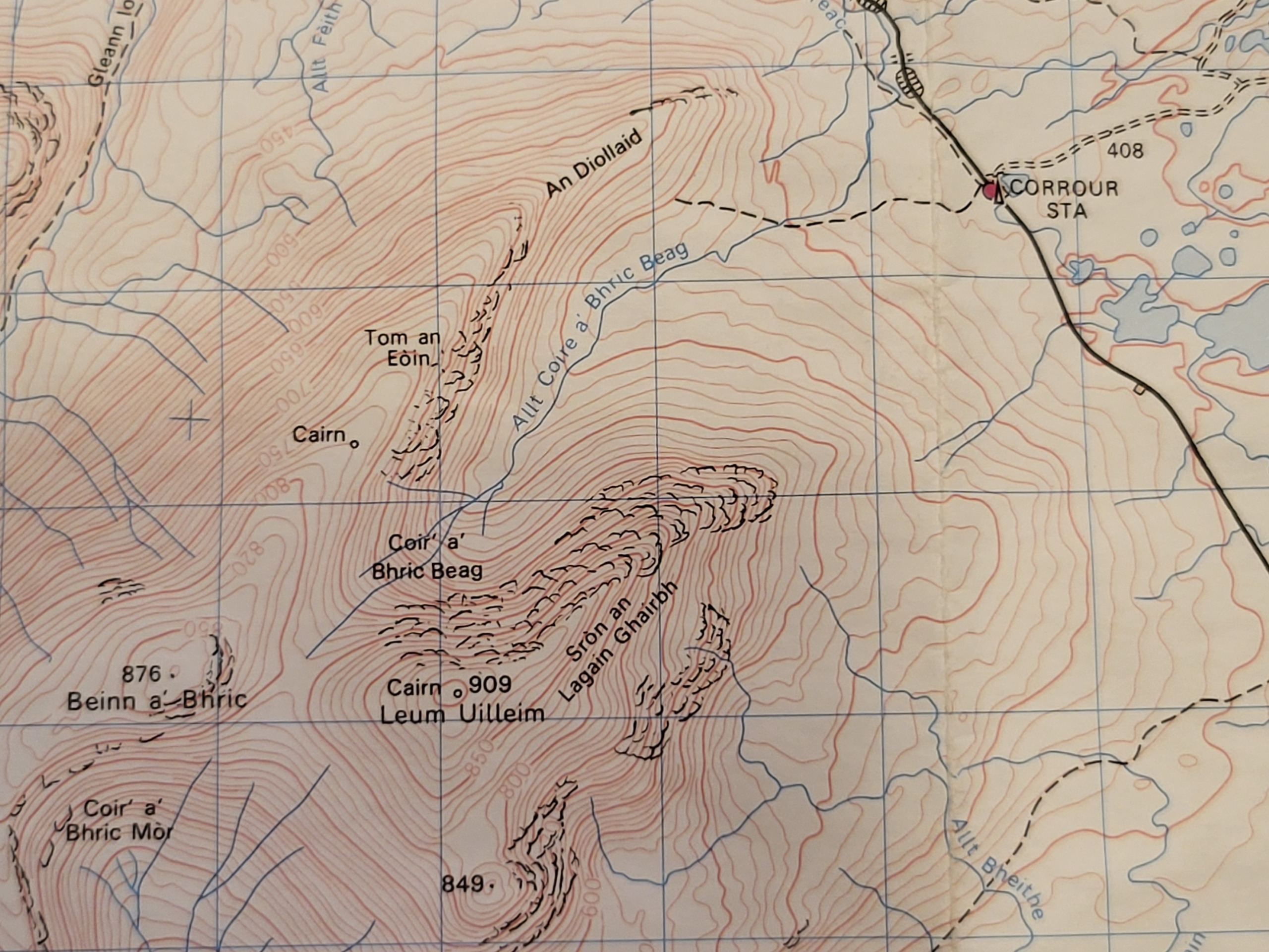
Map of area and locations (OS Landranger 41)
Words and photos by John Gilchrist
We want to keep our roads less busy and our air less polluted. See our Projects.