ROY BRIDGE TO SPEAN BRIDGE VIA THE MONESSIE GORGE BRIDGE
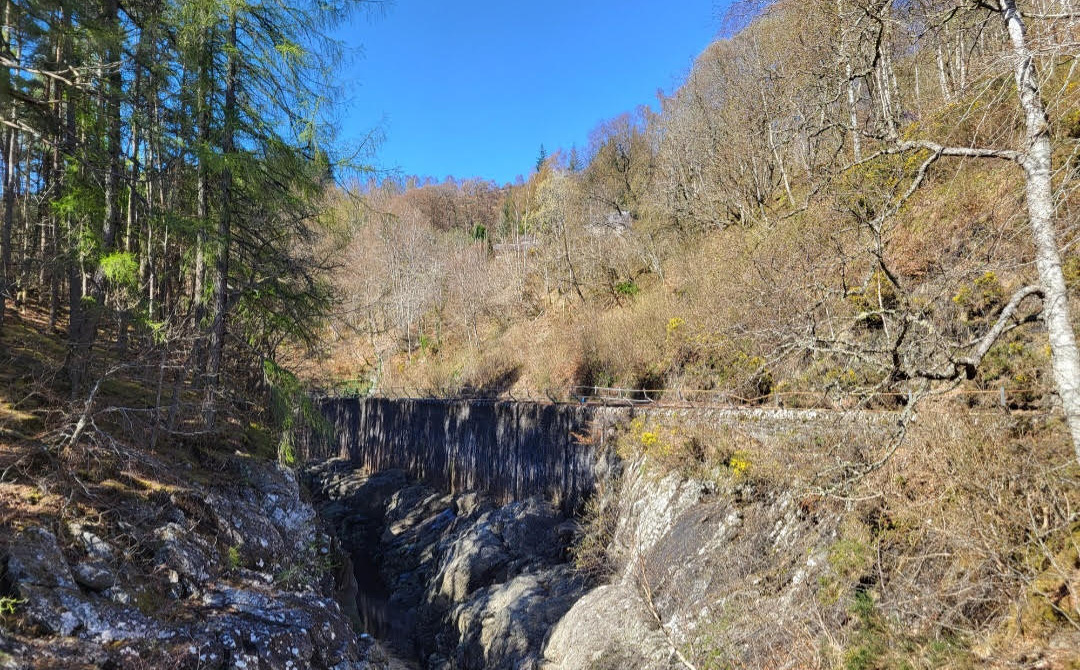
Roy Bridge is a small hamlet that sits to the East side of the Spean valley and has the second last station on the West Highland Line (WHL) before reaching Fort William from the South. The river Spean runs by Roy Bridge and the Monessie Gorge, carved out of rock by the river over millenia, lies some 3 km east of the station. The railway engineers who built the line decided to traverse the narrow and spectacular gorge by building a ledge on its east side, carved into its rock.
The walk between Roy Bridge and the next station west, Spean Bridge, provides a great view of this natural feature as you cross it by the recently refurbished suspension bridge, followed by an easy, low level walk through pastoral farm land, which affords great views of the Spean Valley.
From Fort William and stations from Mallaig, arrive at Roy Bridge at 0804hrs or 1202hrs.
From the south and Glasgow, arrive at 0931hrs (sleeper service), 1149hrs or 1550hrs
See:
Realtimetrains.co.uk
Roy Bridge station once boasted 2 operational platforms and a similar station building to that at Spean Bridge. Alas, like many structures on the WHL, these have succumbed to deterioration, demolition and replacement by a ‘bus shelter’ on the one platform still in use.
After alighting from the train, cross the railway by the road bridge at the east end of the platform and a short walk takes you to the Stronlossit Inn at the junction of the main A86 Fort William to Kingussie road. This walk requires the road to be followed some 3km east and albeit there is no pavement, a large grass verge follows the road on its south (gorge side), and if adhered to, keeps traffic safely distant.
Follow the main road through a largely wooded area and the gorge comes into view to your right as you approach a signpost for the Glen Spean Lodge hotel and a short distance thereafter, the Aite Cruinnichidh hostel. Just beyond the latter lies a sign post to the Cille Choirill churchyard to your left and a small cluster of ruined and inhabited dwellings to your right. Leave the main road and follow the track to the right, through the cluster of cottages, crossing the railway bridge, then walk back west beside fields towards the entrance to Monessie gorge and the suspension bridge, which is accessed via a gate.
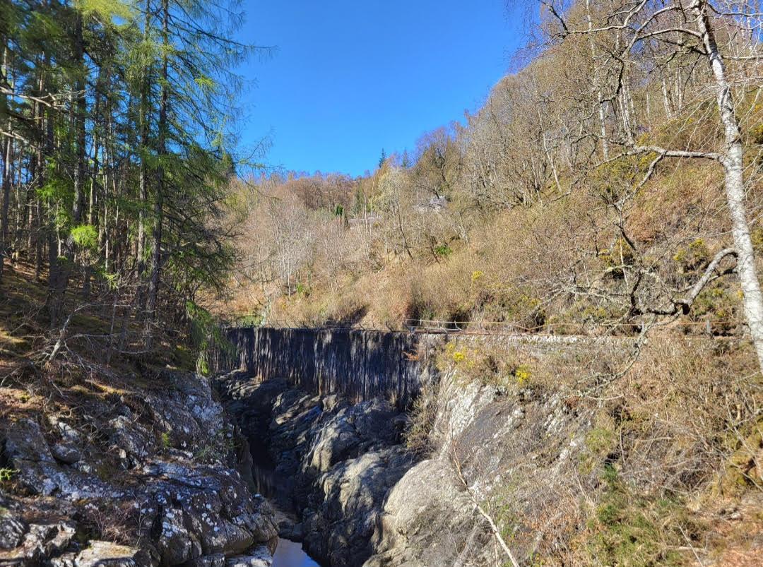
Monessie Gorge and railway from suspension bridge
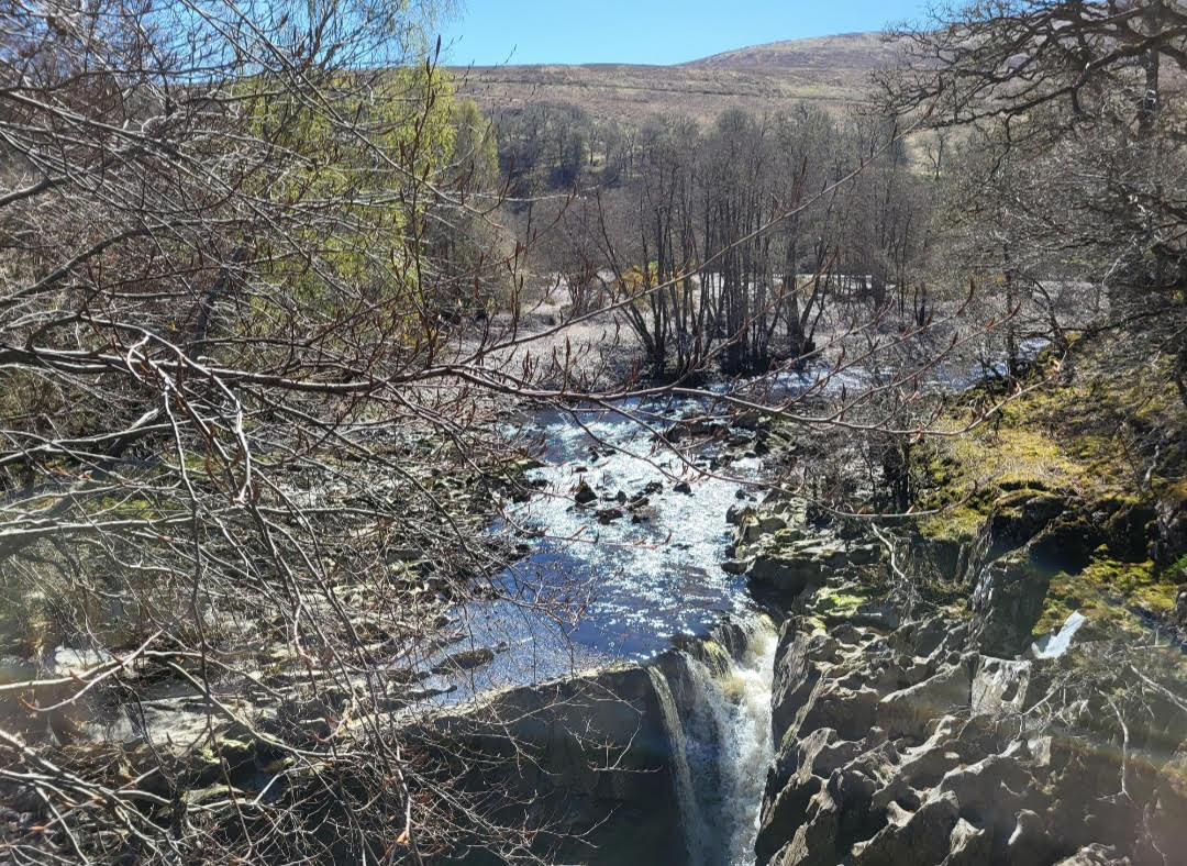
Looking East from the suspension bridge
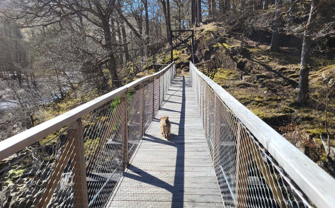
Cross the suspension bridge and follow the well defined path through the woodland that lies to the south of the gorge

Crossing the suspension bridge
The path begins to fade out on leaving the woods and the fields and buildings of Monessie farm emerge to the west. Avoid crossing the fields if livestock are grazing and keep to the field edges. Head towards Monessie farm from where a rough undulating track heads west.
Follow the track, which improves and becomes more defined as you head west, ensuring you close the several gates that lie en route and divide the farmland.
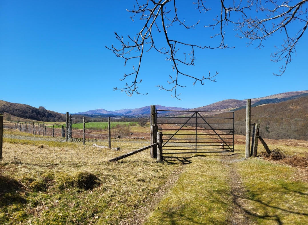
Heading West in Spean Valley
This part of the walk affords expansive views of the Spean valley, the gorge to the north with the railway traversing it.
On the hillside to the south, sits the trackbed of a tramway line built during the postwar construction of the Lochaber hydro electric scheme, as well as the geological features known as ‘parallel roads’, gouged out of the hillside during the ice age.
The track follows the river past a waterfall and an idyllic woodland area containing Inshwood cottage, and a bit further on Roy Bridge itself can be seen across the river.
Do not attempt to cross the river at any point as it does have very strong currents.
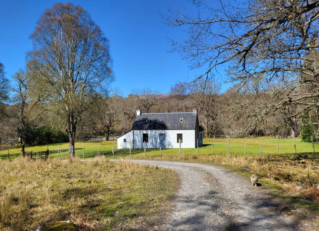
Inshwood cottage
Continue west, through Insh farm, over the metal bridge beside Insh Scout camp site and at the junction with the Corriechoille Lodge the track becomes a tarmac road. Long distance paths to Rannoch, Corrour, Kinlochleven and Glen Nevis are signposted from here.
Continue on the road, crossing the metal bridge over the Allt Coire an Eoin river, and pass the entrance to the Killiechonate estate. A number of woodland walks can be taken from here.
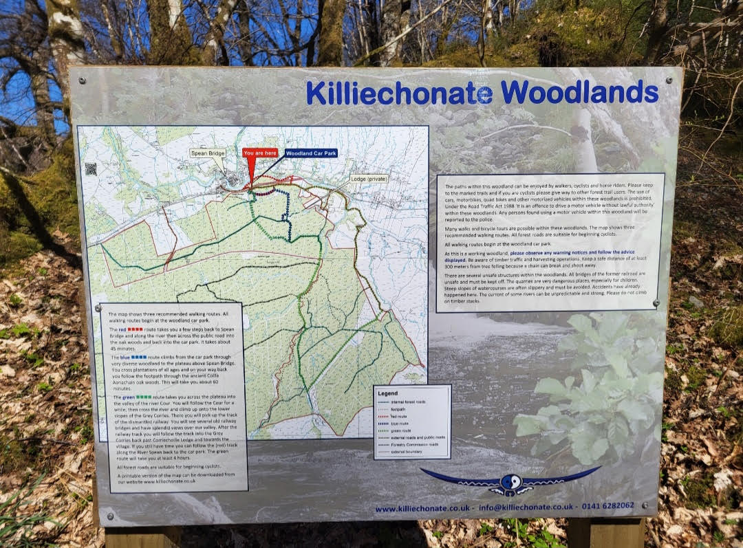
Woodland walks from Killiechonate
The road, river and railway then run parallel from here to Spean Bridge. After another 1.5km, cross the railway by the road bridge and very soon the ‘outskirt’ dwellings and church at Spean Bridge are reached and the station is signposted.
Spean Bridge has several hotels and a Spar shop. The station itself has the original main building still in existence and contains the ‘Old Station restaurant’ which been recently refurbished.
The restaurant serves good food and drink and is a worthy destination after a few hours walking, and before catching the train home.
See: www.oldstationrestaurant.com

Old Station Restaurant, Spean Bridge
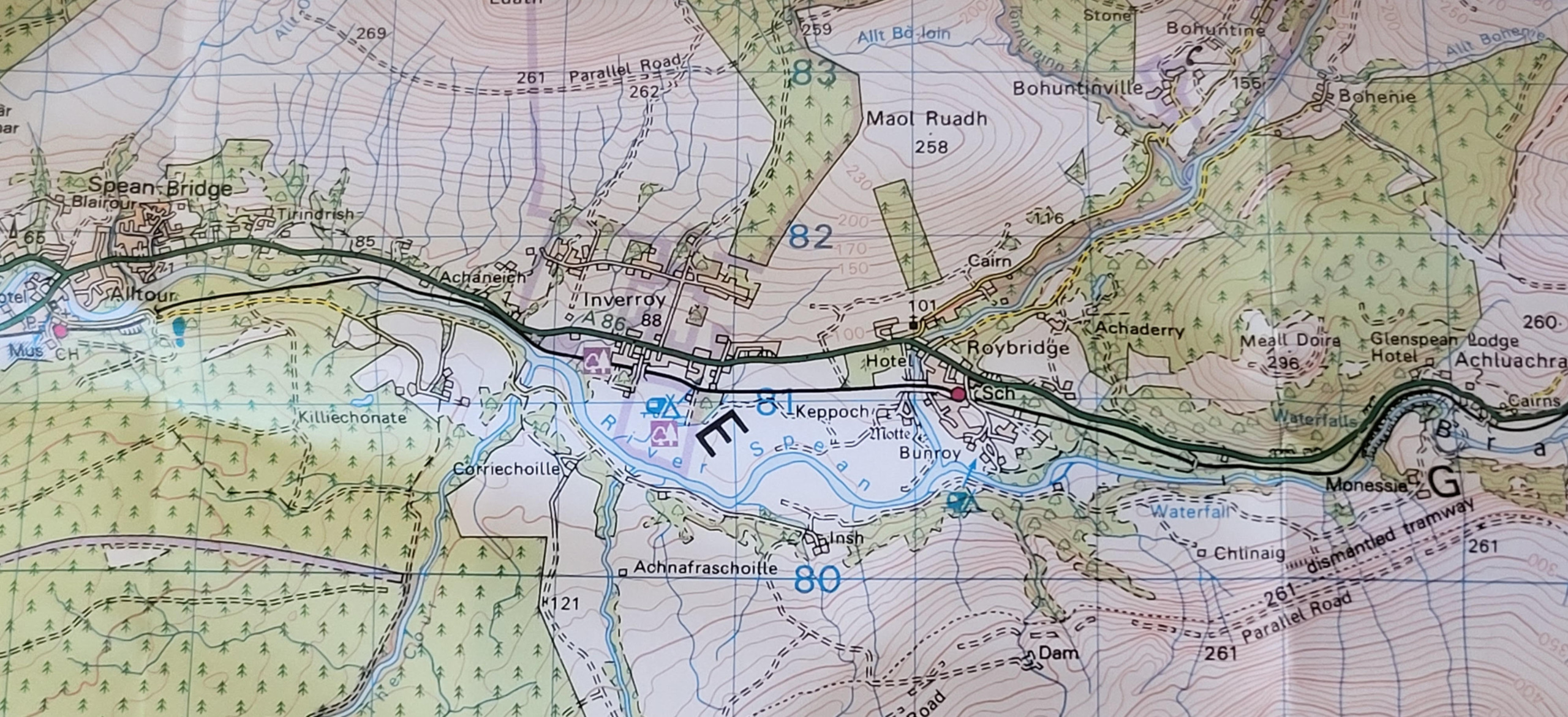
Map of Area: OS Landranger 41
Depart for the North at 1556hrs or 2152hrs and for the South at 1750hrs or 2007hrs (sleeper service)
Summary
Distance: 11 km
Duration: 3 hours
Height: minimal, mostly level with a little undulation in places
Terrain: easy, hill/farm track, initially possibly muddy, becoming well defined track/tarmac road
Map: OS Landranger 41
Words and photos by John Gilchrist
We want to keep our roads less busy and our air less polluted. See our Projects.